Puck Mill Lower Lock: Difference between revisions
Jump to navigation
Jump to search
Created page with '<div style="float:right"> <googlemap lat="51.718353" lon="-2.116907"> 51.724659, -2.117373, Puck Mill Lower Lock </googlemap> </div> '''To the Severn''': [[Bakers Mill Upper Lock…' |
No edit summary |
||
| (2 intermediate revisions by the same user not shown) | |||
| Line 1: | Line 1: | ||
'''To the Severn''': [[Bakers Mill Upper Lock]]<br> | '''To the Severn''': [[Bakers Mill Upper Lock]]<br> | ||
'''To the Thames''': [[Puck Mill Bridge]] | '''To the Thames''': [[Puck Mill Bridge]] | ||
| Line 9: | Line 4: | ||
25.4.14 | 25.4.14 | ||
<gallery> | <gallery> | ||
Image:PuckMillLowerLock1.jpg|A rather overgrown Puck Mill Lower Lock. | |||
Image:PuckMillLowerLock2.jpg|The view towards Sapperton from the head of the lock. | |||
Image:PuckMillLowerLock3.jpg|The head of the lock viewed from the basin in front of it. | |||
Image:PuckMillLowerLock4.jpg|The view east from the lock, [[Puck Mill Bridge]] is buried in the trees next to the house. | |||
</gallery> | </gallery> | ||
[[Category:Thames and Severn Canal]] | [[Category:Thames and Severn Canal]] | ||
Latest revision as of 23:57, 17 April 2026
To the Severn: Bakers Mill Upper Lock
To the Thames: Puck Mill Bridge
2014
25.4.14
-
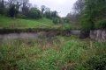
 A rather overgrown Puck Mill Lower Lock.
 -
 The view towards Sapperton from the head of the lock.
 -
 The head of the lock viewed from the basin in front of it.
 -
 The view east from the lock, Puck Mill Bridge is buried in the trees next to the house.


