Cam Brook Viaduct: Difference between revisions
Jump to navigation
Jump to search
BristleGWR (talk | contribs) New page: <div style="float:right"> <googlemap lat="51.342945" lon="-2.350516"> 51.342377, -2.350076, Cam Brook Viaduct </googlemap> </div> '''To Monkton Combe''': Cam Brook Bridge<br> '''To Hal... |
No edit summary |
||
| (5 intermediate revisions by 2 users not shown) | |||
| Line 1: | Line 1: | ||
'''To Monkton Combe''': [[Cam Brook & Twinhoe Road Bridge]]<br> | |||
'''To Hallatrow''': [[Hodshill]]<br> | |||
'''To Monkton Combe''': [[Cam Brook Bridge]]<br> | |||
'''To Hallatrow''': [[]]<br> | |||
== Gallery == | == Gallery == | ||
<gallery> | <gallery> | ||
Image:Cam Brook Viaduct1.jpg|15.11.09. ''© [[:Category:Chris Leahy|Chris Leahy]]'' | |||
</gallery> | </gallery> | ||
[[Category:Camerton Branch]] | [[Category:Camerton Branch]] | ||
[[Category:Chris Leahy]] | |||
[[Category:Viaducts]] | [[Category:Viaducts]] | ||
Latest revision as of 22:54, 12 April 2026
To Monkton Combe: Cam Brook & Twinhoe Road Bridge
To Hallatrow: Hodshill
Gallery
-
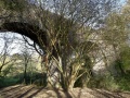 15.11.09. © Chris Leahy
