Bath Road-Frocester: Difference between revisions
Jump to navigation
Jump to search
BristleGWR (talk | contribs) New page: <div style="float:right"> <googlemap lat="51.727972" lon="-2.317193"> 51.727882, -2.317193, Peter's Street </googlemap> </div> '''To Yate''': Frocester<br> '''To the North''': [[Minera... |
No edit summary |
||
| (6 intermediate revisions by the same user not shown) | |||
| Line 1: | Line 1: | ||
'''To Yate''': [[Mineral Railway (Gravel Pits)]]<br> | |||
'''To the North''': [[Lower Fields]] | |||
'''To Yate''': [[ | |||
'''To the North''': [[ | |||
== Gallery == | == Gallery == | ||
29.12.08 | |||
<gallery> | <gallery> | ||
Image:Frocester4.jpg|The bridge at Bath Road as viewed from the bridge at [[Peter's Street]]. | |||
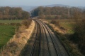
Image:Bath Road-Frocester1.jpg|The view south from Bath Road. | |||
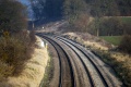
Image:Bath Road-Frocester2.jpg|Three views north. | |||
Image:Bath Road-Frocester3.jpg| | |||
Image:Bath Road-Frocester4.jpg| | |||
</gallery> | </gallery> | ||
[[Category:Gloucester:Bridges]] | |||
[[Category:Bridges]] | |||
[[Category:B&GR]] | [[Category:B&GR]] | ||
[[Category:MR]] | [[Category:MR]] | ||
Latest revision as of 20:15, 12 April 2026
To Yate: Mineral Railway (Gravel Pits)
To the North: Lower Fields
Gallery
29.12.08
-
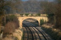 The bridge at Bath Road as viewed from the bridge at Peter's Street.
 -
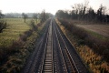 The view south from Bath Road.
 -
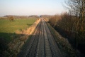 Three views north.
 -
-