Stapleton Road
To Bristol or Bath: St Marks Road
To Wales, The North or London: Stapleton Road Viaduct
History
Opened as a single platform on the 8th September 1863. The line was doubled and a second platform added in 1874 with the opening of the Clifton Extension Railway. The route north to Narroways Hill was quadrupled in 1888, and south to Lawrence Hill in 1891. The station closed to goods on 29th November 1965. The number of tracks through the station was reduced to two from 20th February 1984. A mural was painted on the down platform in August 1999.
Track Plans
-
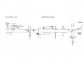 A trackplan of Stapleton Road and surrounding area from 1988.

1960s
-
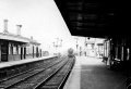 A view of Stapleton Road taken in the early 60s. © Martin Dyson

1970s
-
-
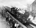
 Demolition work at the station. A poster advertises the opening of Bristol Parkway. © Simon Whittingham
 -
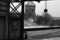 A closer look at the JCB at work. © Simon Whittingham
 -
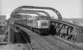 A Peak descends Filton Bank and crosses the bridge at Stapleton Road sometime in the 70s. © Dunstable Dasher
 -
 Followed by a Class 31 on a newspaper train. © Dunstable Dasher
 -
 And a HST. This section of railway has now been removed and this bridge is derelict. © Dunstable Dasher
 -


2004
5.1.04
-
 Standing on the station at the part which crosses St Marks Road.
 -
 A general view towards Lawrence Hill station. On the far left is the scar left by the removal of the main lines. In the distance a Voyager slows for it's final approach to Temple Meads.
 -
 Standing at the Bristol end of the station and looking north.
 -
 A closer look at the distant signal and the footbridge.
 -
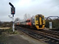
 The signal is Off and a Voyager blasts through.
 -
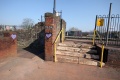
 The footbridge looked at from the other side. This is the original station footbridge, minus roof and halved in length.
 -
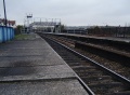
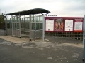
 The platform shelter and information board on Platform 1.
 -
 This mural is next to the platform shelter and gives some historical information about the station.
 -
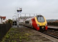
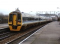
 158842 glides into the station. The feather on the signal is for the line to Severn Beach via Narroways Junction which is just to the north of this station.
 -
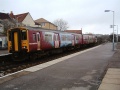
 158840 made up the other part of the train.
 -
 The platform shelter and information board on Platform 2.
 -
-
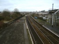
 The view north from the end of Platform 2. The first bridge in the photo is that across the M32, while the footbridge in the background is the one at Narroways Hill. The building at the top of the hill is Brunel Tech.
 -
 This is the same bridge in the Dunstable Dasher's photos in the 1970s section.
 -
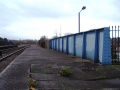
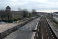
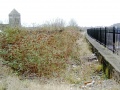 Looking towards Bristol along the formation of the old main lines. The platform edge is still visible, but everything else has disappeared under buddleia.
 -
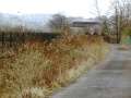 The main line trackbed looking north.


2008
Eastside Roots Community Harvest Fayre. 31.8.08


2013
5.3.13
-
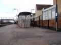
 Work under way in preparation for the installation of a new footbridge.
 -
-


2014
10.3.14
-
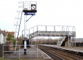
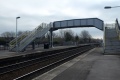 The new footbridge. Higher than the old in readiness for electrification, and built in such a way that it can be easily extended to span the reinstated four track railway.
 -
 The 2014 view south.
 -
 And the view north.


2018


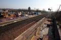
A selection of photos showing the station being prepared for the reinstatement of four running tracks, and the installation of a footbridge with ramps as well as steps. 5.9.18
2019


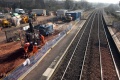
Work in progress on the installation of footbridge ramps, while four tracks have now been reinstated. 9.1.19